Ride the Dunes
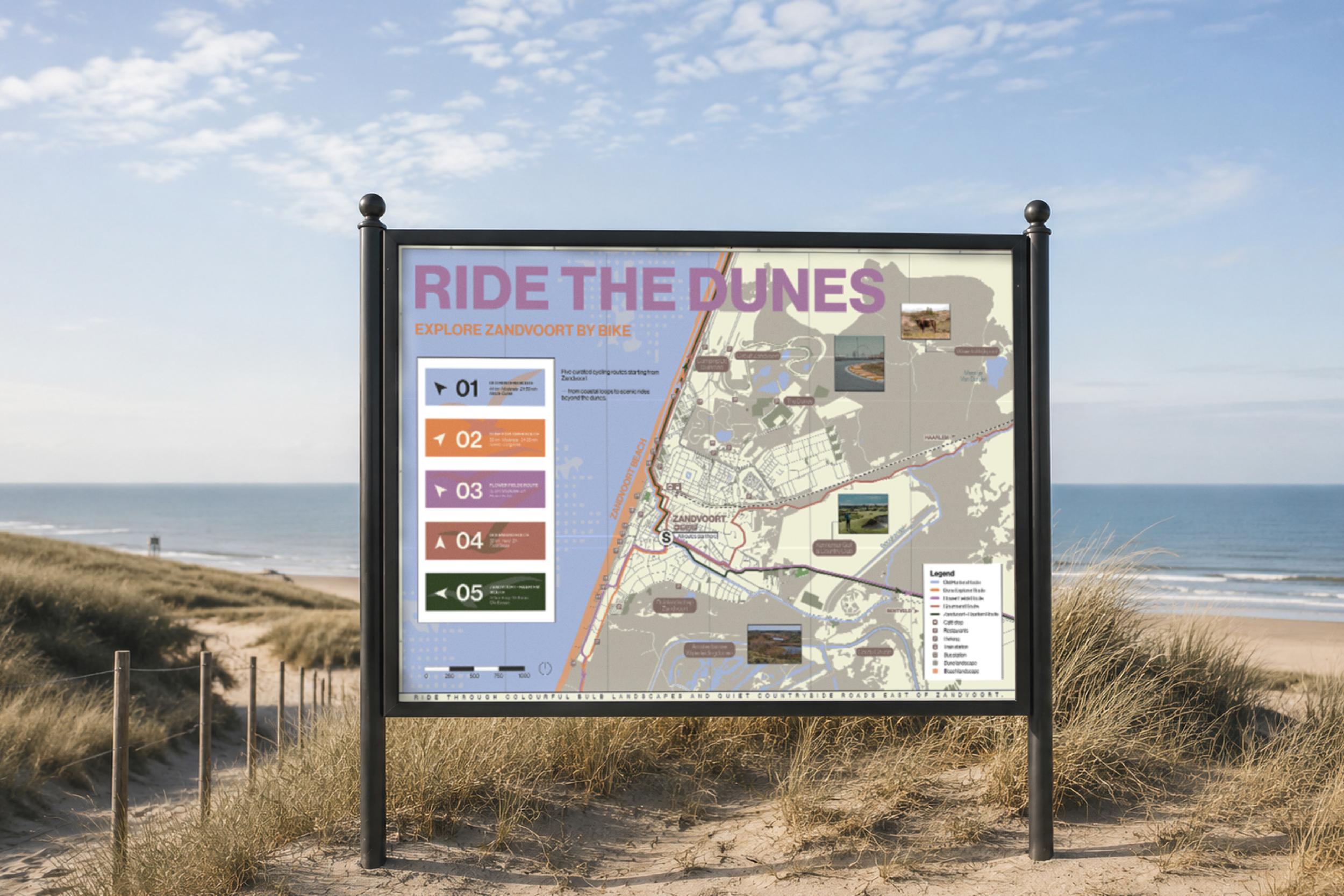
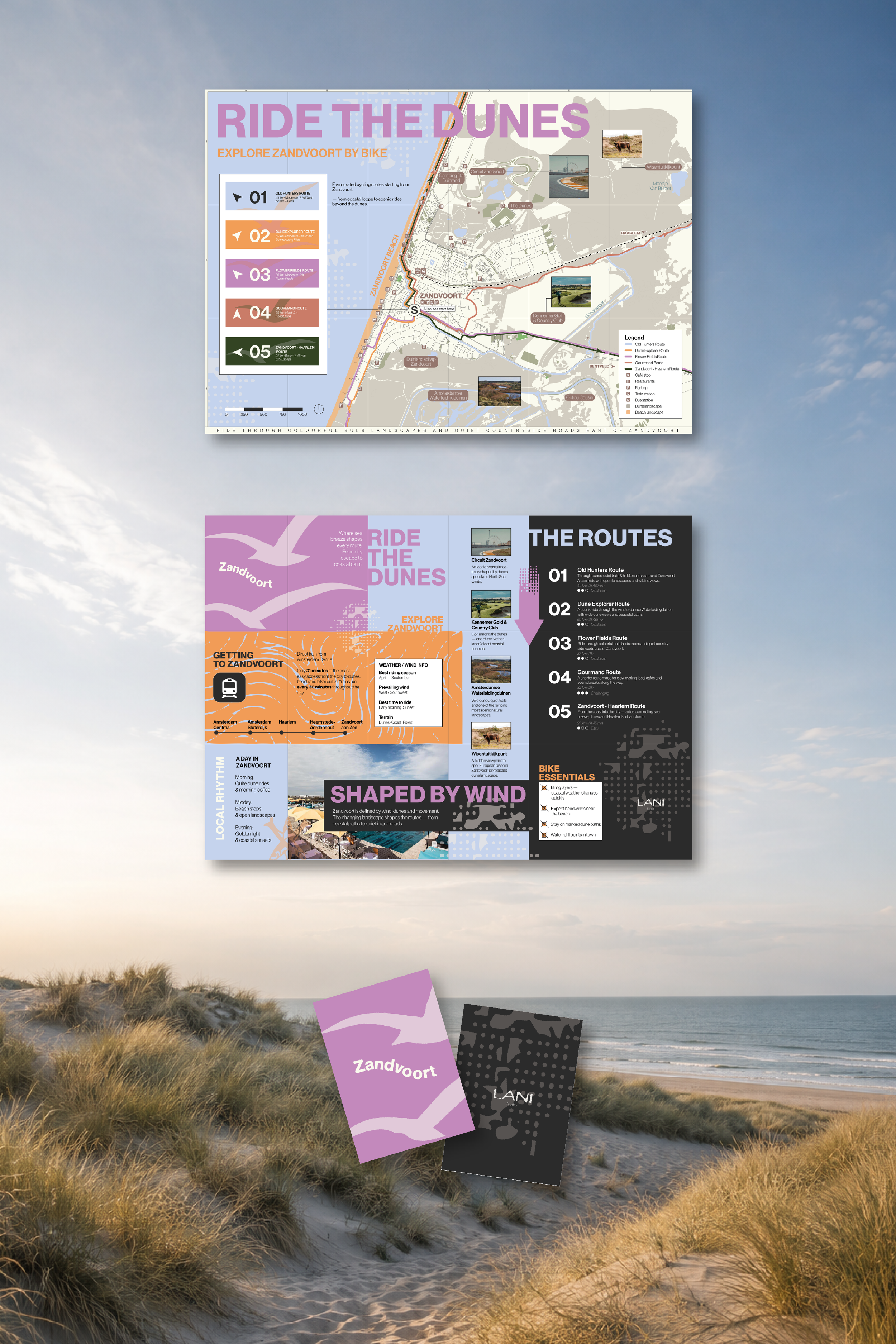
Ride the Dunes is a double-sided A2 cycling map designed to encourage visitors to explore Zandvoort and its surroundings beyond the beach.
Combining cartography, editorial design, and visual storytelling, the project brings together five cycling routes, local highlights, and practical travel information in a colorful, easy-to-navigate format.
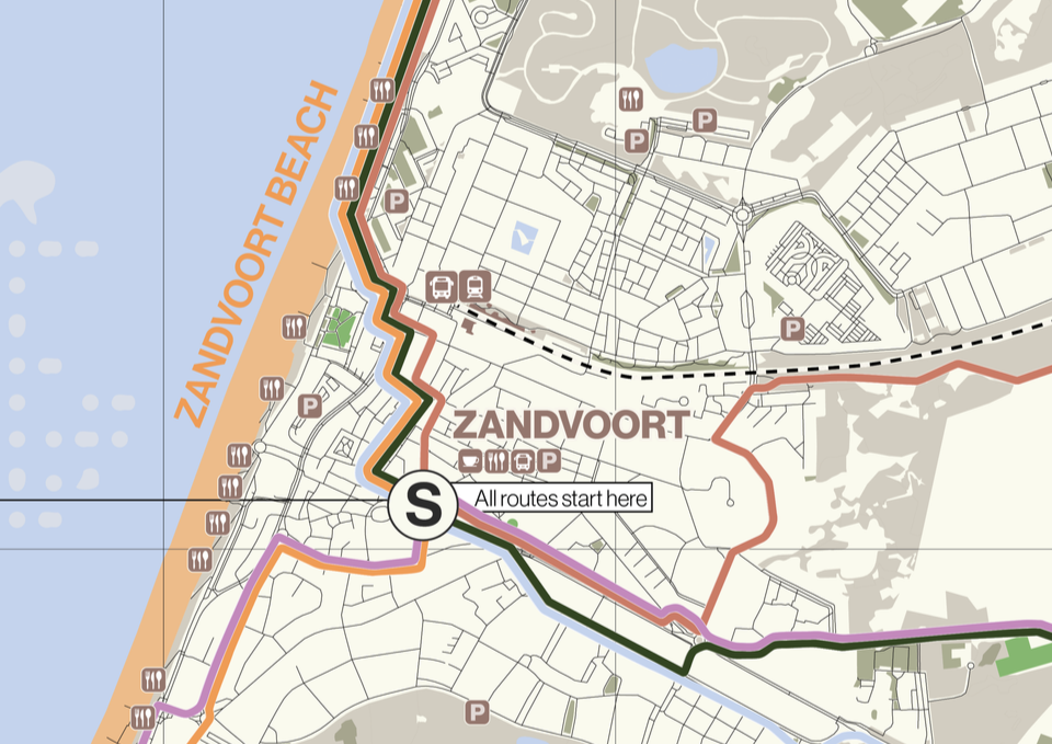
Five Routes. One Starting Point.
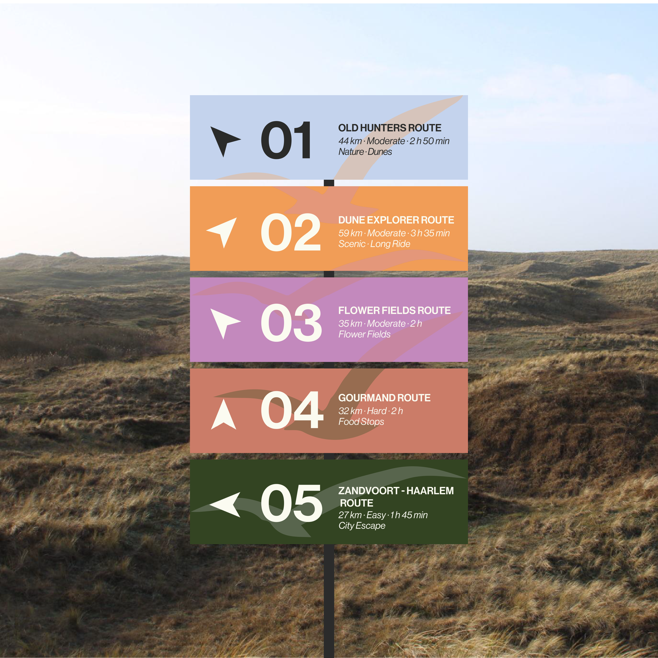
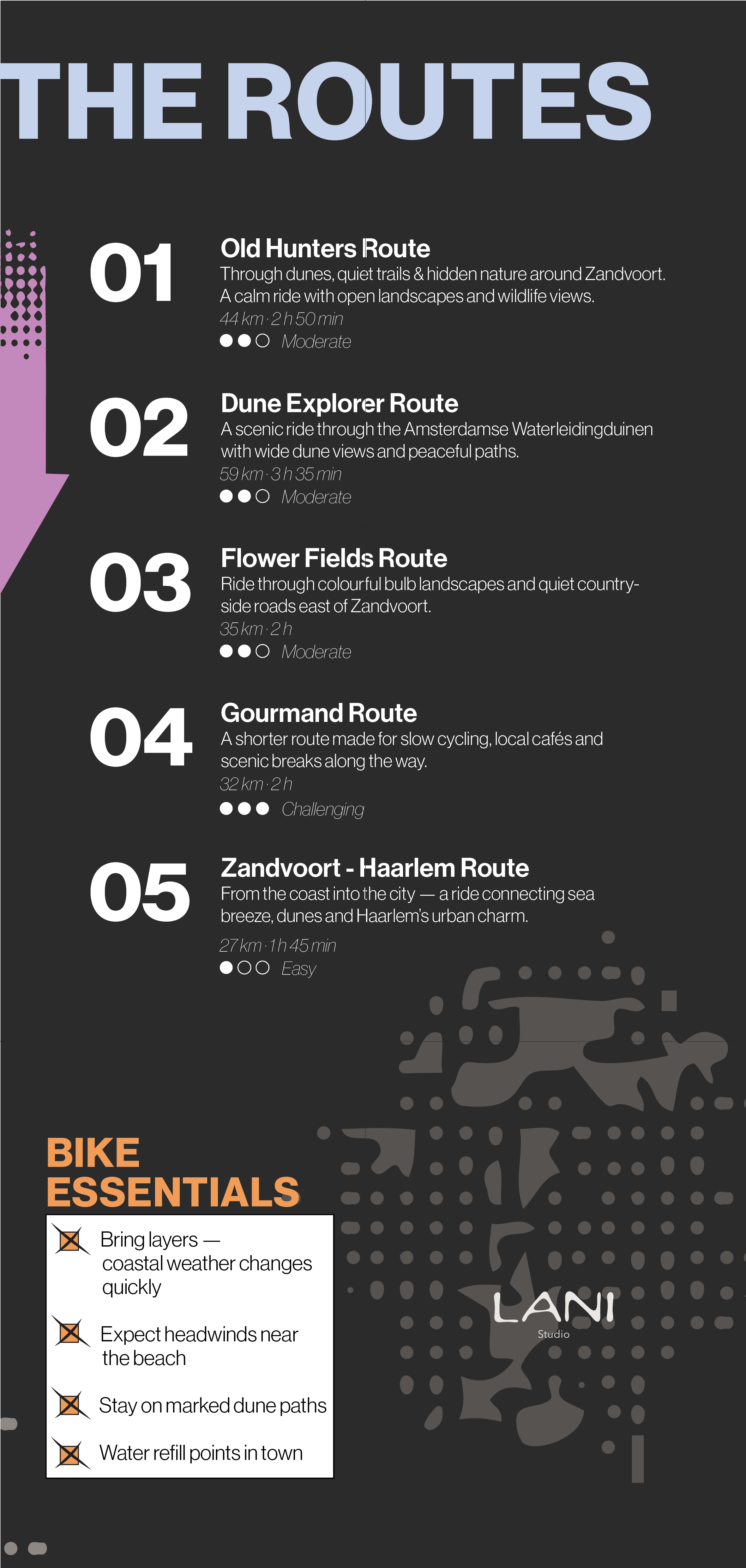
Five individually color-coded cycling routes guide visitors through different landscapes and experiences around Zandvoort.
A clear visual system of colors, typography, and directional icons makes each route easy to identify, while keeping the overall design playful, structured, and accessible.
Beyond the Map
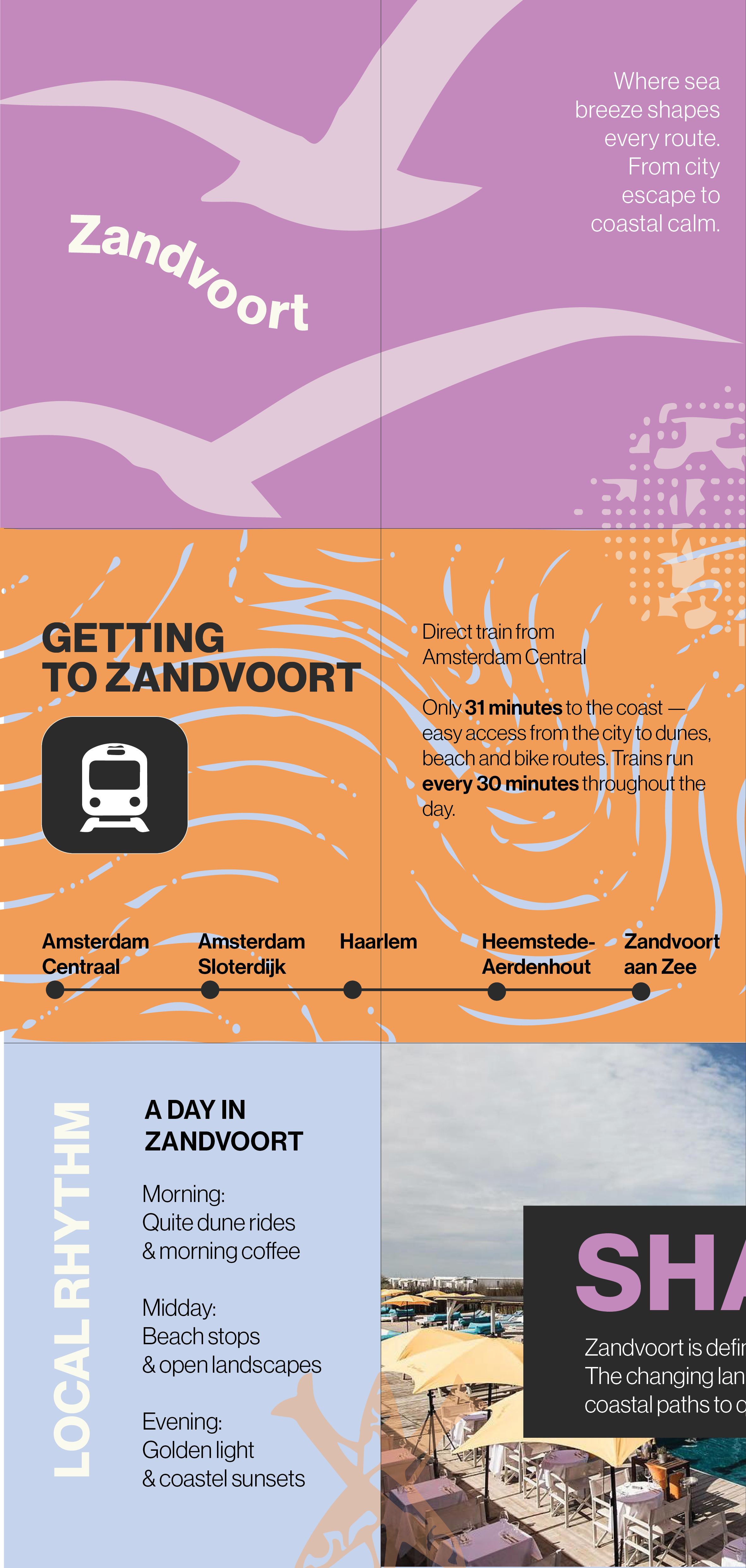
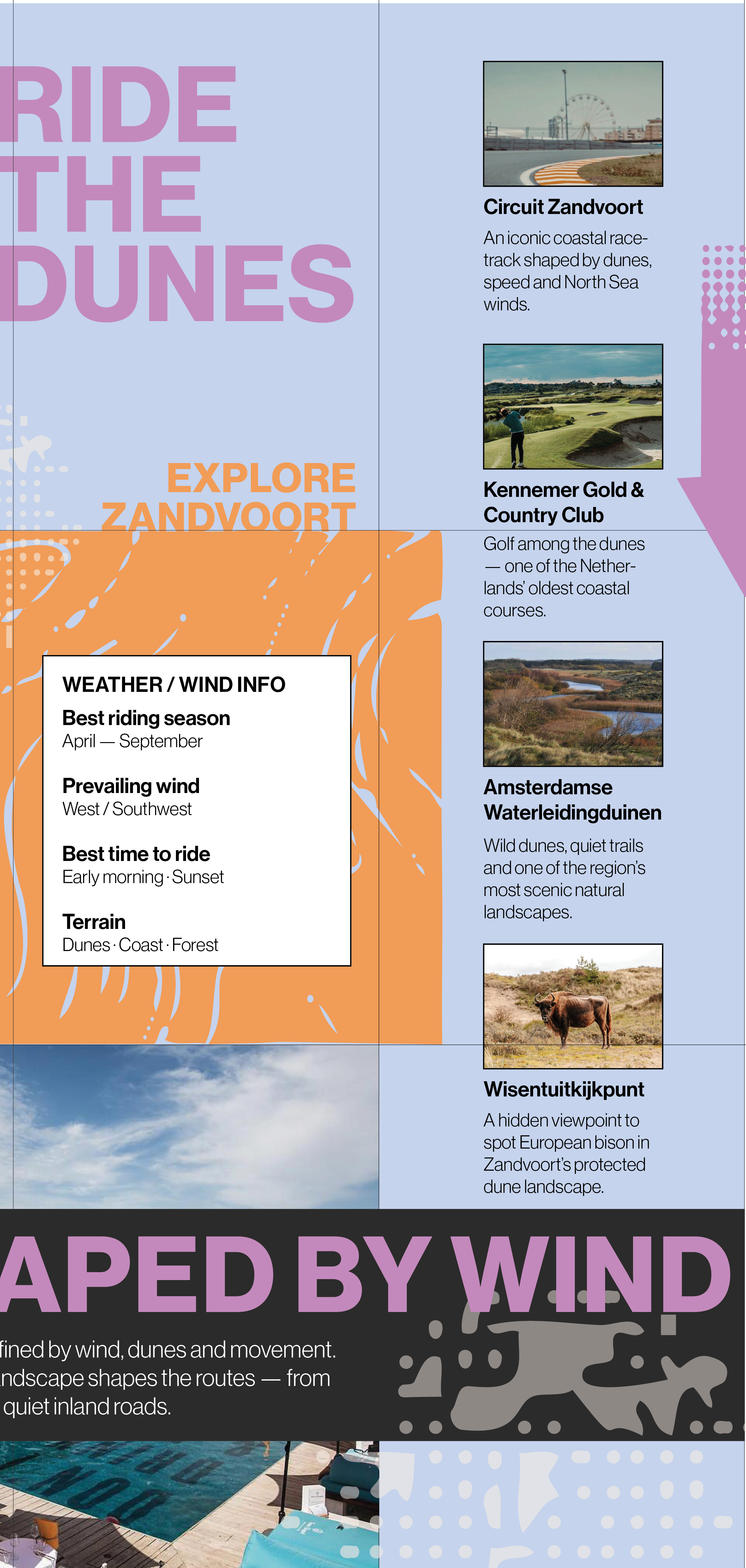
The reverse side transforms the map into a compact travel guide, combining route information, local recommendations, practical tips, and visual storytelling.
A modular editorial layout brings together photography, illustrations, typography, and information graphics to create a cohesive experience across both sides.
The Details
From custom-designed icons and route markers to typography, color coding, and map illustrations, every element was developed as part of one consistent visual language.